To manage animal populations, it is important to understand how many animals there are and where they are in the landscape. When considering a large area, such as the whole of Victoria, this can be a very difficult task, and counting every animal is not feasible. When a species is rare or hard to detect, this can be even more complicated.
To address these challenges, ARI researchers use population models to estimate the number of animals across large areas. They use carefully designed surveys to count animals through portions of the whole area of interest. Using these samples, researchers can then create statistical models that relate the animal counts to environmental factors that affect animal population numbers, such as climate, food and shelter. The resulting statistical models are then used to estimate animal numbers in areas that were not directly surveyed, allowing animal numbers to be assessed across large areas.
Another consideration is the difficulty of accurately counting the animals in the first place. For many reasons, such as dense bush or difficult terrain, it is unlikely all animals that are present in a survey area will be seen and counted. To overcome this, ARI researchers use a variety of methods to better assess the number of animals that are actually present, such as double observer counts or distance sampling.
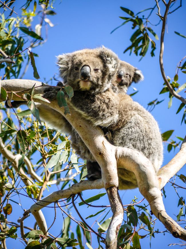
Koala counts using two observers
To increase our understanding of koala populations in East Gippsland, and help understand the impacts of the 2019/20 bushfires, researchers created a population model and compared estimates of koala abundance in burned and unburned areas. To effectively survey for these hard-to-see animals in dense vegetation, two observers would survey the same area in quick succession, and then estimate the distance between themselves and any observed koala. This technique allowed for better estimation of the number of animals that might have been missed by both observers.
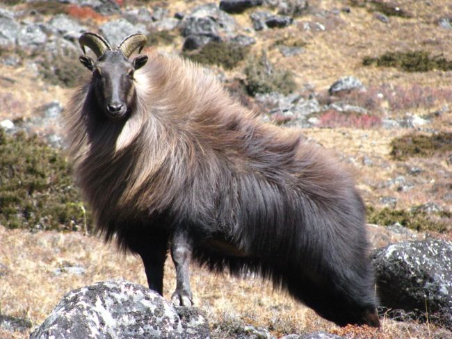
Himalayan tahr in New Zealand
The Himalayan tahr is an introduced ungulate present in New Zealand’s Southern Alps. Traditional survey methods are hard to employ in this area, and so ARI helped to design and implement aerial surveys for these animals, which included multiple flyovers of the same area to accurately estimate tahr density. The population models revealed that they were much more abundant than previously thought, and it has been recognised that more control efforts are now needed.
For more information see this journal article.
Aerial counts of kangaroos
ARI researchers created a population model to estimate the abundance of western grey kangaroos and eastern grey kangaroos in non-forested areas of Victoria, to support sustainable harvest of these species. Aerial surveys were conducted over 3234 km of the state. Observers recorded the distance that kangaroos were from the helicopter, and these data were used to work out how likely it was that a kangaroo would be detected at further distances from the helicopter. This enabled better estimates of kangaroo density, and more accurate estimates of overall abundance.
For more information, see this technical report (PDF).
Deer counts using distance estimates
Introduced deer (e.g. sambar deer, fallow deer) are increasingly impacting native biodiversity across the state. To better manage deer impacts, ARI
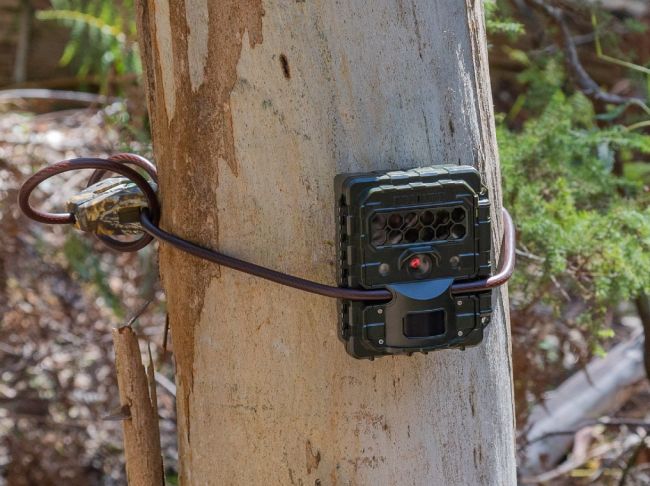
researchers have implemented surveys using remote infrared cameras to record deer numbers at over 400 locations across the state. Researchers used distance markers, placed at various distances from the camera, to measure how far a deer was from the camera. This technique allowed for estimation of deer density at the camera location, instead of just counts of deer. The resulting data will be used to better assess the abundance and distribution of the major deer species across the state.
For more information, see this technical report (PDF).
Population modelling continues to be a critical part of wildlife management worldwide. Using the latest peer-reviewed methods, ARI can estimate population numbers to inform resource managers and measure confidence of model predictions.
This work has been funded by DEECA’s Biodiversity Division, and the New Zealand Department of Conservation.
For more information, contact David.ramsey@delwp.vic.gov.au.
Page last updated: 28/03/25