Skip to content
Skip to navigation
Main Navigation
About us
Open submenu
About ARI
Our people
Contact us
Partner feedback
ARI Updates
Open submenu
eNews
Seminars
Quarterly Updates
Research
Open submenu
Threatened plants, animals and ecosystems
Open submenu
Animals
Open submenu
10inTen – Conservation Hatchery
Brolga
Dingoes
Murray Spiny Crayfish
Freshwater crayfish
Platypus recovery
Watson's Tree Frog
Potoroos and bandicoots
Southern Right Whales in Victoria
Galaxiid research
Barred galaxias conservation
Smoky mouse movement
Dandenong burrowing crayfish in cool temperate rainforest
Murray hardyhead salinity tolerance
Plains-wanderer and Hooded Scaly-foot habitat
Leadbeater’s Possum - camera surveys in trees
Macquarie perch recovery
Freshwater catfish breeding
Central Highland threatened species surveys
Microbats in Victoria
Plants
Open submenu
Winged Peppercress monitoring
Enfield Grevillea
Mount Cole Grevillea
Ecosystems
Open submenu
Critically endangered grasslands on private estates
Melbourne Strategic Assessment Program - ARI
Alpine Sphagnum bogs: if we map them we can manage them
Black Box woodlands restoration
Semi-arid woodland condition
Translocations
Open submenu
River Blackfish translocation
Genetic management of threatened species
Macquarie perch recovery
Waterway management
Open submenu
Environmental water
Open submenu
Environmental water in Victorian rivers
Environmental water in Victorian wetlands
Moorabool Yaluk flow monitoring
Turtles responses to water for the environment
Fish spawning and recruitment
Native fish growth responses to flows
Victorian Murray Floodplain Restoration Project
Black Box woodlands restoration
Hattah Lakes plant response to environmental watering
Freshwater wildlife
Open submenu
The Native Fish Strategy
Eel migration tracking using satellites
River Blackfish translocation
Freshwater turtles cultural conservation
Genetic health of native fish
Fish management advice informs Snowy 2.0
Native Fish Guide for Coastal Victoria
Lower Snowy River fish monitoring
Murray hardyhead salinity tolerance
Macquarie perch recovery
Freshwater catfish breeding
Waterway rehabilitation
Open submenu
Fishways and fish movement
Wetland connectivity
Livestock grazing on wetlands guide
Wetland Intervention Monitoring Program
River rehabilitation model
Finbox - a demonstration reach tool kit
Murray River resnagging
Instream woody habitat restoration
Riparian Intervention Monitoring Program
Instream connectivity for fish
Estuary condition monitoring
Emergency events
Open submenu
Flood recovery 2022-23
Bushfire
Open submenu
Black Summer Bushfires 2019/20
Glossy Black-Cockatoo bushfire recovery
Rainforests: will they cope with a changing fire regime?
Fire Analysis Module for Ecological values (FAME)
Banksia friendly fire regimes
Fire regimes, carbon levels and biodiversity
East Gippsland foothill forests fire ecology
Black Saturday Bushfires 2009 - Natural Values Recovery Program
Burrowing crayfish post-fire survey methods
Endangered grassy ecosystems and fire
Nature-led Community Resilience
Windstorm forest recovery - Dandenong Ranges
Environmental management
Open submenu
Monitoring
Open submenu
Waterbirds at the Western Treatment Plant
Soil health
Plant monitoring manual
Mud Islands monitoring of nesting birds
Windstorm forest recovery - Dandenong Ranges
Revegetation benefits for conservation
Semi-arid woodland condition
Native Fish Report Card Program
Restoration thinning in Box-Ironbark forest
Eel migration tracking using satellites
Native vegetation management improvement
Snake venom bank collaboration
Waterbird surveys in Western Port
Estuary condition monitoring
Wetland Intervention Monitoring Program
Wildlife management
Open submenu
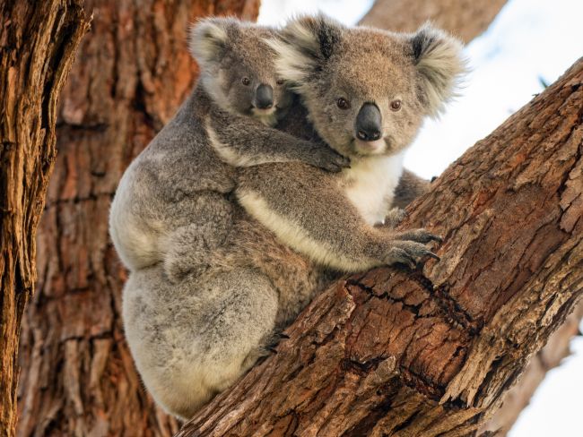
Koala statewide survey
Koala translocation
Wildlife abundance estimates in Victoria
Introduced animals and plants
Open submenu
Fox management best-practice guidelines
Weed control in threatened native grasslands
Feral pigs population structure using genetics
Rabbit biological control
Deer-livestock interaction and disease
National emergency response system for introduced freshwater fish
Carp biomass estimates
Carp impact mitigations
Invasive wetland species management
Private land
Open submenu
Livestock grazing on wetlands guide
Stock management in the Mallee
Neospora caninum transmission in dairy farms
Critically endangered grasslands on private estates
Technology and skills
Open submenu
Artificial intelligence
Open submenu
AI Wildlife call recognition
Artificial intelligence identifies frogs – by their calls
Expert elicitation
Open submenu
Ecosystem condition assessments using expert judgements
Biodiversity knowledge framework
Modelling
Open submenu
Habitat distribution models (HDMs)
Mapping vegetation extent and condition
Wildlife abundance estimates in Victoria
Population viability analysis models for threatened species
Regional Forest Agreements research
Population modelling software
Population models for fish and waterway management
Population models for native fish flow responses
Monitoring techniques
Open submenu
AI Wildlife call recognition
Audio recorder settings for AI
Artificial intelligence identifies frogs – by their calls
Camera trapping
Drones
Electrofishing technology
Environmental DNA’s use in biodiversity monitoring and research
Game bird ageing and sexing using features
Wildlife disease
Open submenu
Wildlife disease risk in Victoria
Neospora caninum transmission in dairy farms
Deer-livestock interaction and disease
Rabbit biological control
Strategic projects for policy
Open submenu
Science for renewable energy policy
Fire Analysis Module for Ecological values (FAME)
Biodiversity knowledge framework
10inTen – Conservation Hatchery
Regional Forest Agreements research
People and nature
Open submenu
Victorians Value Nature
Open submenu
How Victorians can act for nature
Measuring connection with nature
Victorians Value Nature Survey
Nature-led Community Resilience
Citizen Science
Open submenu
Southern Right Whales in Victoria
Fishers fishing for fish ear bones
Gone Growling
The frogs are calling you
Birding is better when we work together
Citizen science - looking for Rainbow Lorikeets
Nest boxes in Victoria
Wombat Forest: co-manager shared vision
Walk with our scientists in VR
Services
Open submenu
Environmental monitoring & field expertise
Data analysis, modelling, genetics & decision support tools
Ecological expert advice
Nature investment advice
Science communication
Publications
DEECA services
DEECA news
DEECA office locations
DEECA logo
DEECA services
Agriculture Victoria
Climate action
Energy
Environment
Explore outdoors
Forest Fire Management Victoria
Forests and reserves
Marine and coasts
Resources Victoria
Solar Victoria
Water and catchments
Wildlife
DEECA home
Site Search
Search
Toggle search
Open menu
Menu
Site Search
Search:
Arthur Rylah Institute
Research
Threatened plants, animals and ecosystems
Waterway management
Emergency events
Environmental management
Technology and skills
Strategic projects for policy
People and nature
Wildlife management
Working with waterway managers to guide environmental water delivery
Monitoring
Open submenu
Waterbirds at the Western Treatment Plant
Soil health
Plant monitoring manual
Mud Islands monitoring of nesting birds
Windstorm forest recovery - Dandenong Ranges
Revegetation benefits for conservation
Semi-arid woodland condition
Native Fish Report Card Program
Restoration thinning in Box-Ironbark forest
Eel migration tracking using satellites
Native vegetation management improvement
Snake venom bank collaboration
Waterbird surveys in Western Port
Estuary condition monitoring
Wetland Intervention Monitoring Program
Wildlife management
Open submenu
Koala statewide survey
Koala translocation
Wildlife abundance estimates in Victoria
Introduced animals and plants
Open submenu
Fox management best-practice guidelines
Weed control in threatened native grasslands
Feral pigs population structure using genetics
Rabbit biological control
Deer-livestock interaction and disease
National emergency response system for introduced freshwater fish
Carp biomass estimates
Carp impact mitigations
Invasive wetland species management
Private land
Open submenu
Livestock grazing on wetlands guide
Stock management in the Mallee
Neospora caninum transmission in dairy farms
Critically endangered grasslands on private estates
Page last updated: 28/03/25
Close