In short
|
Floods are changing
Floods are natural disturbances in Victoria. Many species that live within and around waterways are adapted flood cycles, depending on them for migration, breeding events and rejuvenation.
However, natural flood events are increasing in severity and frequency in Victoria due to climate change and urbanisation. Altered flood regimes are changing the conditions and habitat resources for many waterway, wetland and floodplain species.
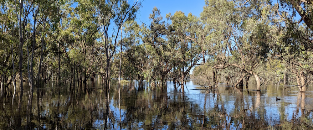
In October 2022, heavy rainfall and storms caused major flooding across Victoria, becoming the largest flood event recorded in the last 50 years. This caused significant impacts on both human communities and natural environments.
Understanding the impacts of floods on species and the ecosystem will inform improved conservation management, making our ecosystems more resilient and better prepared for future major climate events.
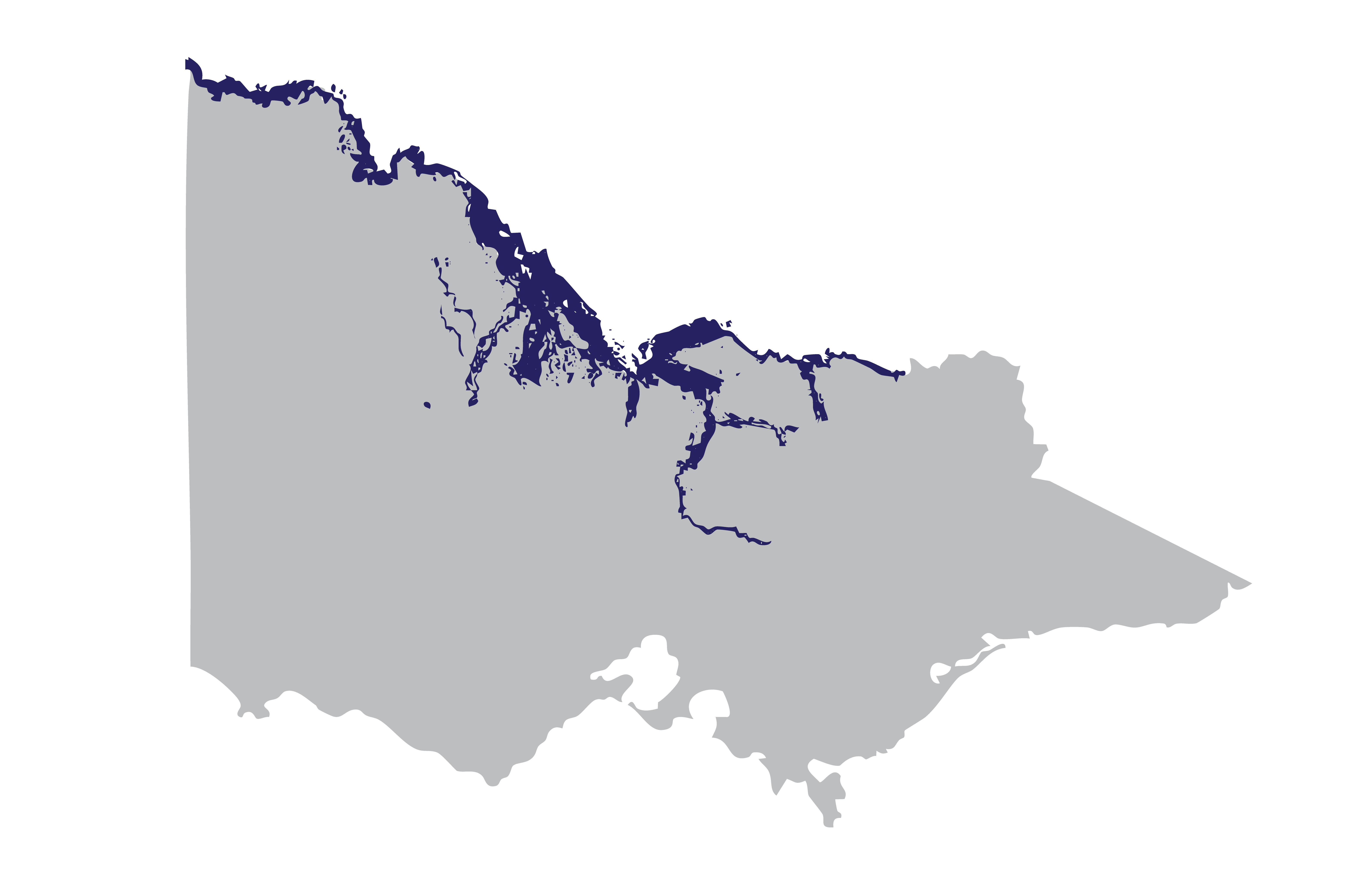
Victorian 2022 flood extent map (Source: Digital Twin Victoria)
What we have been doing
As part of the Victorian Government’s Flood Recovery Program, ARI monitored and assessed the impacts of floods on threatened species and ecosystems. Our research helps inform mitigation actions to support recovery and prepare for future flood events.
Our work focused on key threatened species and habitats, and invasive species, that were likely impacted by the October 2022 floods. These included:
- freshwater fish populations and habitats
- invasive species such as Common Carp
- threatened plant populations
- threatened mammals, reptiles and bird species
We worked with local communities and stakeholders to improve land management and emergency response, aiming for better biodiversity and stronger community values.
Native aquatic species were significantly impacted by the floods, with the potential for long-term consequences. Through captive breeding programs and translocations, our fish ecologists strived to support population recovery and increase genetic diversity for five species: Murray Cod, Trout Cod, Macquarie Perch, Southern Purple Spotted Gudgeon, and Murray Spiny Crayfish. These conservation actions support the resilience of species and ecosystems to future natural disasters.
Key outcomes:
- Re-stocked over 500,000 individuals across the five species in various catchments areas in Victoria.
- Collected broodstock for each species from catchments for captive breeding at ARI, Arcadia hatchery and Snobs Creek hatchery.
- ARI and the Victorian Fisheries Authority (VFA) partnered with Dja Dja Wurrung People (DJAARA) to share knowledge about managing their culturally significant crayfish, the Murray Spiny Crayfish. Together, we released craylings to bolster their populations in flood-impacted waterways.
- Genetic samples from wild Macquarie Perch populations were collected to support the genetic management plan being prepared by the Macquarie Perch Recovery Group.
- A new Macquarie Perch population was established at Kiewa River within the species’ historic range.
Learn more about our captive breeding programs for aquatic species on the 10inTen Plan Webpage.
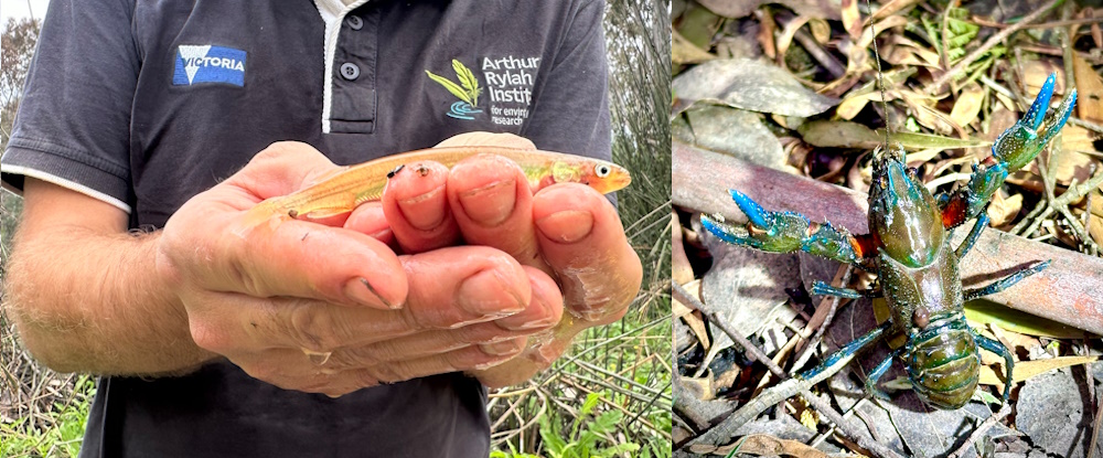
Threatened species supported in the flood recovery program. Photo Tim Fernando.
Invasive aquatic species like Common Carp can rapidly increase in number after flood events. Carp hinder native species recovery by competing for food and habitat resources and reducing the water quality of aquatic environments. Our ARI researchers collaborated with stakeholders and local communities to remove invasive species, helping rehabilitate our aquatic ecosystems and support the recovery of native fish.
Key outcomes:
- ARI removed 773 carp across 20 sites along the Ovens River using boat-mounted electrofishing.
- We removed 350 carp from three wetland sites: Brickworks Billabong, Ducksfoot Lagoon and Wallpolla Horseshoe. Carp removal at these sites support the population recovery of native species living in these sites such as Murray Hardyhead, Silver Perch and Growling Grass Frog.
- Rehabilitation efforts are underway to help native species recover, including revegetation and the provision of environmental flows.
- In collaboration with Zoos Victoria, we supported the captive breeding and release of the endangered Spotted Tree Frogs into the West Kiewa River.
- We repaired a fish barrier on the West Kiewa River and remove non-native species such as Brown and Rainbow trout, and willow trees. These interventions support the recovery of Spotted Tree Frogs and native fish species.
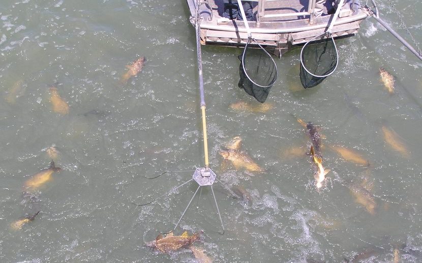
Demonstration of electrofishing in practice to remove carp.
Large flooding events can influence both flood-adapted and dryland plants. Our botanists surveyed over 50 populations of three threatened species: Winged Peppercress, Stiff Groundsel and Spiny Lignum. These assessments have helped us to better understand these species and will inform management actions for future flood events.
Key findings:
- All target plant species were found to be healthy and new populations were discovered.
- Target species appear to have benefitted from consecutive years of high rainfall and the 2022 flood event.
- Consistent annual monitoring is recommended to accurately report on species’ status changes after disturbances like floods and fires.
Publications:
- Threatened flora: Stiff Groundsel factsheet (PDF, 570.3KB)
- Threatened flora: Spiny Lignum factsheet (PDF, 695.6KB)
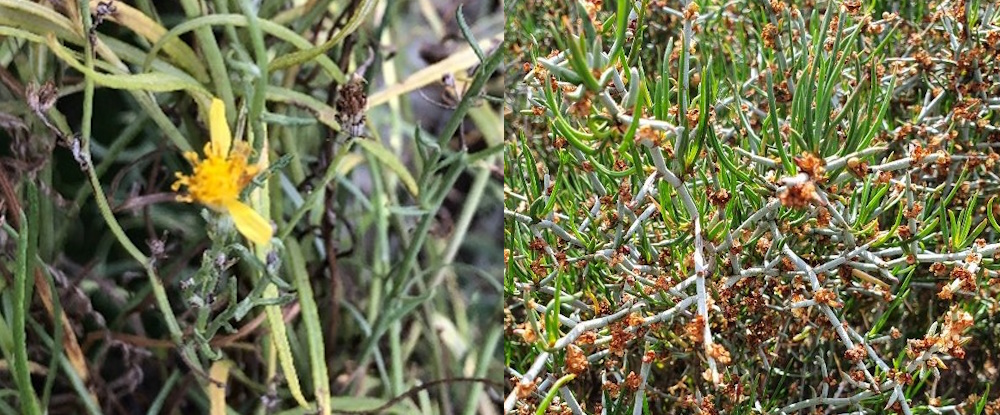
Stiff Groundsel in flower (left) and Spiny Lignum (right).
Floods can affect a species’ habitat in many ways including the availability of shelter and food resources. Our teams surveyed a variety of mammals, birds, and reptiles to assess their population status and investigate the effectiveness of survey techniques.
Key findings:
- The Gile’s Planigale was recorded by ARI scientists for the first time in 11 years in Victoria. Both the Giles’ Planigale and Fat-tailed Dunnart were found following the floods.
- The Hooded Scaly-foot, a species of legless lizard, was found at three of four surveyed sites where they were previously recorded prior to the floods.
- Traditional spotlighting was a more effective survey method compared to thermal imaging surveys, allowing for better detection against the surrounding vegetation.
- Small mammals were most effectively detected using camera traps installed with drift-net fences, which could be used for future monitoring as an alternative to live pitfall trapping.
- Acoustic lures, using call playback, were found to improve trapping success of the South-eastern Long-eared Bat. Our surveys confirmed the presence of a population in a new location in north-central Victoria.
- Less than 2% of trees surveyed appeared to have collapsed due to the floods. Suitable nesting hollows for Regent Parrots and Superb Parrots were rare but this was not due to flood impacts on hollow-bearing trees. Recovery of these species is unlikely to be improved by the installation of generic nest boxes.
- ARI’s Artificial Intelligence (AI) ‘deep learning’ call recogniser was enhanced to detect many threatened bird species. Audio recorders deployed in and around floodplain areas of north and north-western Victoria collected calls of several rare bird species. This technique offers a more reliable cost-effective monitoring technique for threatened bird species, and will continue to improve with additional call data.
Publications:
- Hooded Scaly-foot population and habitat impact assessment fact sheet (PDF, 897.0KB)
- Flood Recovery: availability of suitable tree hollows for Regent and Superb Parrots fact sheet (PDF,1.6MB)
- Flood Recovery: tracking the South-eastern Long-eared bat in Gunbower bat fact sheet (PDF,1.2MB)
- Flood Recovery: Threatened small mammal population assessments fact sheet (PDF, 710.0KB)
- Detection of threatened floodplain bird species using Artificial Intelligence fact sheet (PDF,587.6KB)
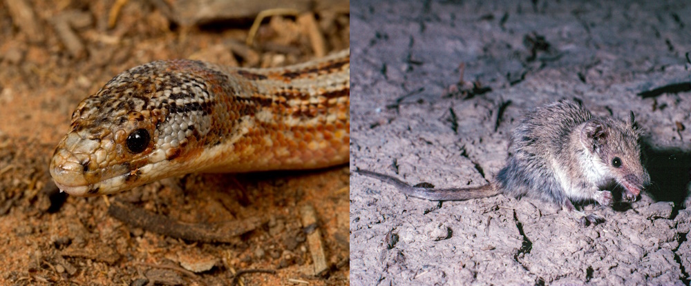
Hooded scaly-foot (left) and Giles' Planigale (right, photo credit Lindy Lumsden).
With natural emergency events increasing in frequency, supporting community preparedness and recovery is needed. Nature-led Community Resilience (NLCR) is about helping communities strengthen their connection with nature to support their resilience and recovery. After the 2022 flooding events, a toolkit was developed to guide communities to integrate NCLR activities into emergency management and planning for the future of both people and nature.
Learn more about this project on the Nature-led Community Resilience (NLCR) Toolkit webpage.
More information
For more information about ARI’s flood recovery projects, contact research.ari@deeca.vic.gov.au.
Page last updated: 24/02/26